| Geocortex Essentials Sites Directory | Sign In Sign Out ( Guest ) |
Map Service: Terrain (ID: __root__basemaps42)
Service Loaded: Apr, 7 2026 03:05:19 PM PDT (UTC--07:00)
Connection String: url=https://services.arcgisonline.com/ArcGIS/rest/services/World_Terrain_Base/MapServer
Short Display Name: N/A
Description:
Copyright: Sources: Esri, USGS, NOAA
Visible: True
Opacity: 0.53
Minimum Scale: N/A
Maximum Scale: N/A
Image Format: N/A
Service Type: Tiled
Service Function: Basemap
Basemap Transparency Slider Group: N/A
Basemap Transparency Slider Group Index: N/A
Server Version: 11.3
Failure Action: Ignore
Failure Timeout (seconds): 5
Drawing Behavior: MapService
Request Encoding: N/A
Icon: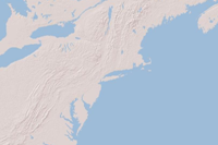
Include in Layer List: True
Is Expanded: True
Supports Dynamic Layers: False
Supports Layer Catalog: False
Update Interval (seconds): N/A
Disable Client Caching: False
Identifiable: N/A
Time Zone ID: N/A
Data Provider: Default
Layers:
Tables:
Coordinate System: WGS_1984_Web_Mercator_Auxiliary_Sphere (WKID: 102100)
Operational Coordinate System: N/A
Tile Info:
Layer Hyperlinks:
Instant Search: False
Supported Interfaces: REST
Connection String: url=https://services.arcgisonline.com/ArcGIS/rest/services/World_Terrain_Base/MapServer
Short Display Name: N/A
Description:
This map is designed to be used as a base map by GIS professionals to overlay other thematic layers such as demographics or land cover. The base map features shaded relief imagery, bathymetry, and coastal water features designed to provide a neutral background for other data layers. The map was compiled from a variety of sources from several data providers, including the U.S. Geological Survey, NOAA, and Esri. The base map currently provides coverage for the world down to a scale of ~1:1m and coverage for the continental United States and Hawaii to a scale of ~1:70k. For more information on this map, including our terms of use, visit us online at https://goto.arcgisonline.com/maps/World_Terrain_Base
Copyright: Sources: Esri, USGS, NOAA
Visible: True
Opacity: 0.53
Minimum Scale: N/A
Maximum Scale: N/A
Image Format: N/A
Service Type: Tiled
Service Function: Basemap
Basemap Transparency Slider Group: N/A
Basemap Transparency Slider Group Index: N/A
Server Version: 11.3
Failure Action: Ignore
Failure Timeout (seconds): 5
Drawing Behavior: MapService
Request Encoding: N/A
Icon:
Include in Layer List: True
Is Expanded: True
Supports Dynamic Layers: False
Supports Layer Catalog: False
Update Interval (seconds): N/A
Disable Client Caching: False
Identifiable: N/A
Time Zone ID: N/A
Data Provider: Default
Layers:
Tables:
Coordinate System: WGS_1984_Web_Mercator_Auxiliary_Sphere (WKID: 102100)
Operational Coordinate System: N/A
Tile Info:
- Height: 256
- Width: 256
- DPI: 96
-
Tile Info: (# of levels: 14)
- Level: 0
- Resolution: 156543.033928
- Scale: 591657527.591555
- Level: 1
- Resolution: 78271.5169639999
- Scale: 295828763.795777
- Level: 2
- Resolution: 39135.7584820001
- Scale: 147914381.897889
- Level: 3
- Resolution: 19567.8792409999
- Scale: 73957190.948944
- Level: 4
- Resolution: 9783.93962049996
- Scale: 36978595.474472
- Level: 5
- Resolution: 4891.96981024998
- Scale: 18489297.737236
- Level: 6
- Resolution: 2445.98490512499
- Scale: 9244648.868618
- Level: 7
- Resolution: 1222.99245256249
- Scale: 4622324.434309
- Level: 8
- Resolution: 611.49622628138
- Scale: 2311162.217155
- Level: 9
- Resolution: 305.748113140558
- Scale: 1155581.108577
- Level: 10
- Resolution: 152.874056570411
- Scale: 577790.554289
- Level: 11
- Resolution: 76.4370282850732
- Scale: 288895.277144
- Level: 12
- Resolution: 38.2185141425366
- Scale: 144447.638572
- Level: 13
- Resolution: 19.1092570712683
- Scale: 72223.819286
Layer Hyperlinks:
N/A
Instant Search: False
Supported Interfaces: REST