| Geocortex Essentials Sites Directory | Sign In Sign Out ( Guest ) |
Map Service: Light Gray Overlay (ID: 20)
Service Loaded: Sep, 30 2025 12:32:47 PM PDT (UTC--07:00)
Connection String: url=https://services.arcgisonline.com/ArcGIS/rest/services/Canvas/World_Light_Gray_Base/MapServer
Short Display Name: N/A
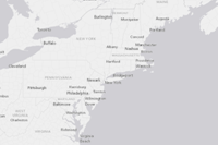
Description: Light Gray layer is useful for cartographic display of thematic overlay layers by simplifying the map surface and providing contrast to view desired layers more clearly.
Copyright: Esri, HERE, Garmin, (c) OpenStreetMap contributors, and the GIS user community
Visible: False
Opacity: 0.8
Minimum Scale: N/A
Maximum Scale: N/A
Image Format: Png32
Service Type: Tiled
Service Function: Basemap
Basemap Transparency Slider Group: N/A
Basemap Transparency Slider Group Index: N/A
Server Version: 11.3
Failure Action: Ignore
Failure Timeout (seconds): N/A
Drawing Behavior: MapService
Request Encoding: N/A
Icon:
Include in Layer List: True
Is Expanded: False
Supports Dynamic Layers: False
Supports Layer Catalog: False
Update Interval (seconds): N/A
Disable Client Caching: N/A
Identifiable: N/A
Time Zone ID: N/A
Data Provider: Default
Layers:
Tables:
Coordinate System: WGS_1984_Web_Mercator_Auxiliary_Sphere (WKID: 102100)
Operational Coordinate System: N/A
Tile Info:
Layer Hyperlinks:
Instant Search: False
Supported Interfaces: REST
Connection String: url=https://services.arcgisonline.com/ArcGIS/rest/services/Canvas/World_Light_Gray_Base/MapServer
Short Display Name: N/A
Description: Light Gray layer is useful for cartographic display of thematic overlay layers by simplifying the map surface and providing contrast to view desired layers more clearly.
Copyright: Esri, HERE, Garmin, (c) OpenStreetMap contributors, and the GIS user community
Visible: False
Opacity: 0.8
Minimum Scale: N/A
Maximum Scale: N/A
Image Format: Png32
Service Type: Tiled
Service Function: Basemap
Basemap Transparency Slider Group: N/A
Basemap Transparency Slider Group Index: N/A
Server Version: 11.3
Failure Action: Ignore
Failure Timeout (seconds): N/A
Drawing Behavior: MapService
Request Encoding: N/A
Icon:
Include in Layer List: True
Is Expanded: False
Supports Dynamic Layers: False
Supports Layer Catalog: False
Update Interval (seconds): N/A
Disable Client Caching: N/A
Identifiable: N/A
Time Zone ID: N/A
Data Provider: Default
Layers:
Tables:
Coordinate System: WGS_1984_Web_Mercator_Auxiliary_Sphere (WKID: 102100)
Operational Coordinate System: N/A
Tile Info:
- Height: 256
- Width: 256
- DPI: 96
-
Tile Info: (# of levels: 24)
- Level: 0
- Resolution: 156543.033928
- Scale: 591657527.591555
- Level: 1
- Resolution: 78271.5169639999
- Scale: 295828763.795777
- Level: 2
- Resolution: 39135.7584820001
- Scale: 147914381.897889
- Level: 3
- Resolution: 19567.8792409999
- Scale: 73957190.948944
- Level: 4
- Resolution: 9783.93962049996
- Scale: 36978595.474472
- Level: 5
- Resolution: 4891.96981024998
- Scale: 18489297.737236
- Level: 6
- Resolution: 2445.98490512499
- Scale: 9244648.868618
- Level: 7
- Resolution: 1222.99245256249
- Scale: 4622324.434309
- Level: 8
- Resolution: 611.49622628138
- Scale: 2311162.217155
- Level: 9
- Resolution: 305.748113140558
- Scale: 1155581.108577
- Level: 10
- Resolution: 152.874056570411
- Scale: 577790.554289
- Level: 11
- Resolution: 76.4370282850732
- Scale: 288895.277144
- Level: 12
- Resolution: 38.2185141425366
- Scale: 144447.638572
- Level: 13
- Resolution: 19.1092570712683
- Scale: 72223.819286
- Level: 14
- Resolution: 9.55462853563415
- Scale: 36111.909643
- Level: 15
- Resolution: 4.77731426794937
- Scale: 18055.954822
- Level: 16
- Resolution: 2.38865713397468
- Scale: 9027.977411
- Level: 17
- Resolution: 1.19432856685505
- Scale: 4513.988705
- Level: 18
- Resolution: 0.597164283559817
- Scale: 2256.994353
- Level: 19
- Resolution: 0.298582141647617
- Scale: 1128.497176
- Level: 20
- Resolution: 0.149291070823808
- Scale: 564.248588
- Level: 21
- Resolution: 0.0746455354119042
- Scale: 282.124294
- Level: 22
- Resolution: 0.0373227677059521
- Scale: 141.062147
- Level: 23
- Resolution: 0.018661383852976
- Scale: 70.5310735
Layer Hyperlinks:
- The Light Gray Overlay base map layer is turned on by default for improved visibility of layers that are selected for viewing. Viewing many layers over aerial imagery can be difficult to see clearly. ("#")
Instant Search: False
Supported Interfaces: REST